Volcanic Awakening: NASA's Stunning Views of Raikoke's Eruption
Written on
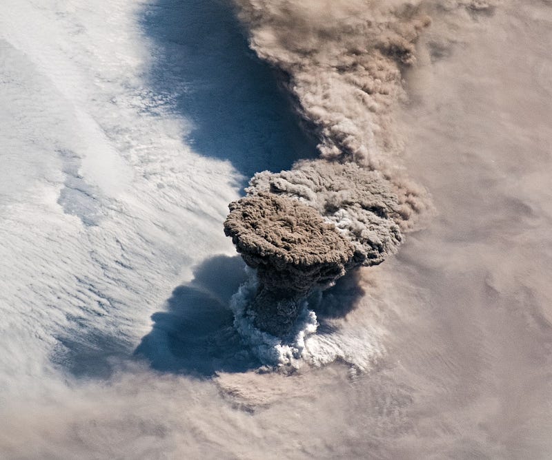
On June 22, 2019, Raikoke volcano, dormant for almost a century, erupted unexpectedly. This island, known for its past eruptions in 1924 and 1778, released a massive cloud of ash and gas from its central crater at approximately 4:00 AM local time.
Despite its isolation in a volcanic chain near the active Kamchatka peninsula in Eastern Asia, the eruption was first detected not through ground-based monitoring, but by Earth-observing satellites and astronauts aboard the International Space Station (ISS). This event underscores the critical importance of satellite-based monitoring, particularly as discussions about funding these programs continue.
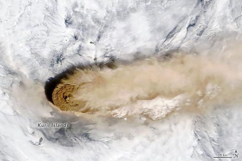
At first glance, one might underestimate the significance of such eruptions. Raikoke is just one among numerous uninhabited volcanic islands linking Hokkaido, Japan, to Kamchatka, Russia, within the Kuril island chain, which consists of 56 islands, of which only eight are inhabited.
While the island may primarily attract the attention of scientists—especially biologists and geologists—due to its unique ecosystem and stratovolcanic structure, its eruption bears wider implications. Rising to 550 meters (1,800 feet) above sea level, with a steep-walled crater 200 meters (660 feet) deep, Raikoke's last eruption in 1778 had catastrophic consequences, destroying a significant portion of the island.
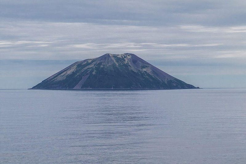
Modern eruptions, such as the recent one, carry substantial risks, even in remote areas. Increased human activity near these natural features, coupled with rising populations—over 10,000 reside in the Kuril islands—heightens the potential dangers. Moreover, with the proliferation of aviation routes, volcanic ash poses a significant threat to aircraft safety. Continuous monitoring of both active and dormant volcanoes is essential for ensuring public safety.
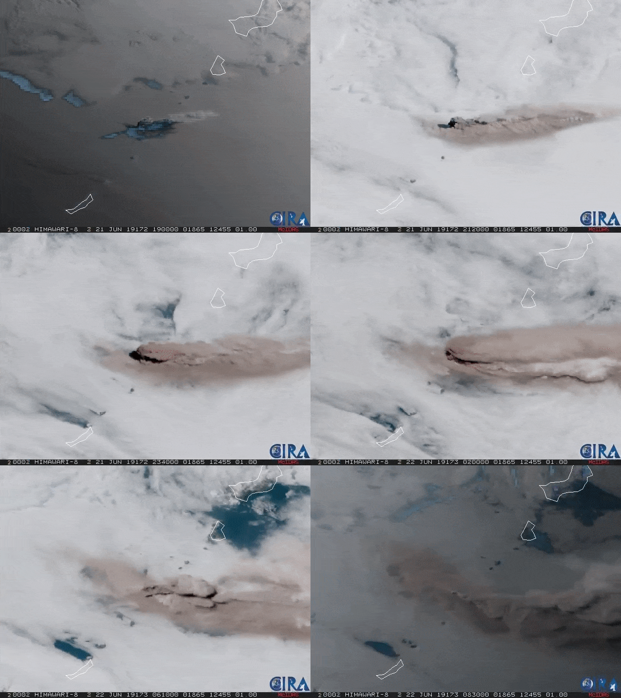
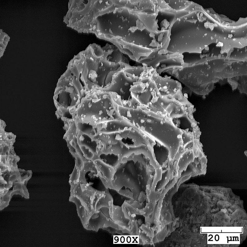
The eruption, documented by various satellite observatories, exhibited pulses over several hours, with plumes reaching heights between 13,000 and 17,000 meters (43,000 to 56,000 feet), surpassing the troposphere and entering the stratosphere. The dispersion of ash and sulfur dioxide into the atmosphere poses serious risks to any nearby populations, as volcanic ash is not merely ash but a mixture of rock, mineral, and glass fragments as small as 4 microns. This fine material is abrasive and can cause significant mechanical and health hazards.
Situated along the Pacific Ring of Fire, Raikoke island is among hundreds of volcanoes in this seismically active region, with about 10% being currently active. Space-based monitoring is crucial for ongoing assessments of volcanic activity and the movement of ash and gases.
Volcanic eruptions also influence global climate. Eruptions release sulfur-rich gases, which can alter land and water conditions for kilometers around. When sulfur aerosols reach the stratosphere, they reflect sunlight and modify cloud formations, leading to temporary cooling effects. Historical eruptions like Mount Pinatubo have greatly enhanced our understanding of this phenomenon, suggesting that controlled release of stratospheric sulfur could be a potential geoengineering approach to climate change.
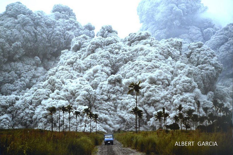
While the visual spectacle of volcanic eruptions captivates many, their destructive potential cannot be overlooked. Eruptions can force evacuations and result in long-term damage to agriculture, infrastructure, and communities. The most effective tool against these natural disasters is monitoring, which provides critical information for mitigating their impact on human lives and property.
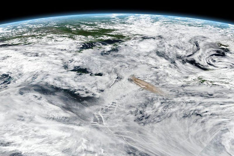
Volcanic Ash Advisory Centers across the globe utilize satellite data to track ash plumes, crucial for aviation safety. A variety of NASA satellites, including Terra, Suomi NPP, and CALIPSO, play a vital role in monitoring not just ash but also volcanic gases, which can have extended implications for aviation and climate.
The endeavor to monitor Earth for such hazards requires international collaboration and commitment to minimizing risks to humanity.
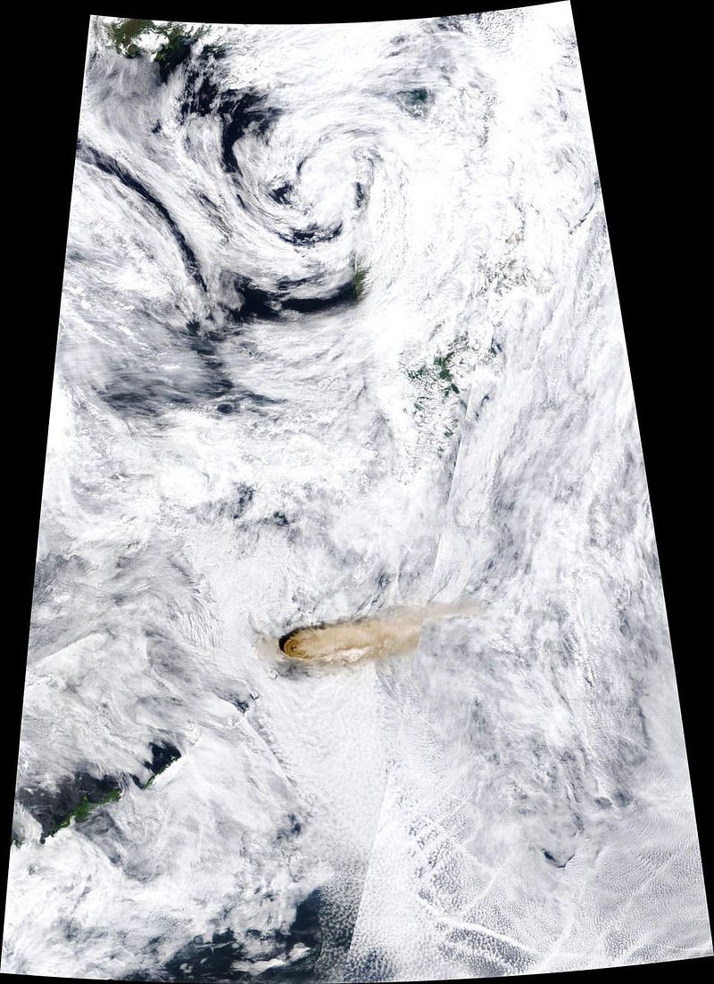
Through continuous space monitoring, scientists can observe the behavior of volcanic plumes. In the case of Raikoke, the eruption produced a narrow, vertical plume that later expanded into an umbrella shape. This occurs when the plume's density matches that of the surrounding air, halting its vertical ascent. The most revealing images come from low-Earth orbit, particularly those captured by ISS astronauts.
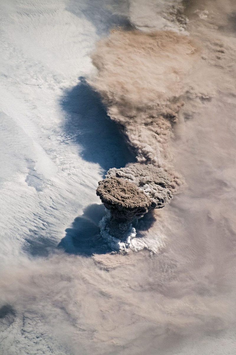
In the above image, the volcanic plume is visible piercing through the cloud cover, forming a ring likely composed of water vapor. Volcanologist Simon Carn explains this phenomenon as potentially involving ambient air being drawn into the plume or interactions between magma and seawater due to Raikoke's island status.
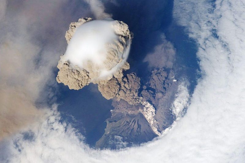
For enthusiasts of spectacular volcanic imagery from space, this eruption may remind one of the June 12, 2009 eruption of Sarychev volcano in the Kuril islands.
Volcanoes are both awe-inspiring and perilous natural phenomena. With effective monitoring, they can be among the most manageable disasters. Approximately 1,500 potentially active volcanoes exist on Earth, excluding submerged or dormant ones that may awaken unexpectedly.
To minimize risks to lives and property, comprehensive and continuous global monitoring is essential. Reductions in these efforts can jeopardize safety, while recognizing the value of Earth observation is crucial for navigating the complexities of life on our dynamic planet.